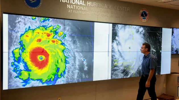
(ST GEORGE’S, Grenada) — Warmer-than-usual ocean temperatures have allowed for the earliest-ever Category 4 hurricane on record to barrel through the Atlantic Basin, records show.
Hurricane Beryl was a Category 4 storm Monday morning as it approached the Caribbean islands of St. Vincent, Grenadines, Grenada, and Carriacou and Petite Martinique islands – the first-ever hurricane recorded during the month of June.
Sea surface temperatures are at record highs, with temperatures in the Atlantic, where hurricanes form, measuring two or three degrees Celsius higher than normal in the Caribbean Sea, according to the National Oceanic and Atmospheric Administration (NOAA). The current temperatures are typical for September, not for the start of July.
On average, the first hurricane of the Atlantic season tends to form during early to mid-August. The first Category 3 generally doesn’t usually occur until Sept. 1, records show.
The previous record for the earliest Category 4 was held by Hurricane Dennis on July 7, 2005. Considering how warm water temperatures are right now, Hurricane Beryl is the type of outlier that meteorologists expected to see this season, Brian McNoldy, a tropical meteorology researcher at the University of Miami, told ABC News.
Forecasts show another tropical disturbance could be close behind Beryl and could target many of the same parts of the Caribbean.
Hurricane strength is rated according to the Saffir-Simpson Scale, with Category 1 storms exhibiting maximum sustained winds of 74 to 95 MPH. A Category 5 storm has maximum sustained winds of 157 MPH or higher. As storms increase in strength, some experts are debating whether to add a Category 6 intensity level to the scale.
Oceans are staying warmer for longer periods, potentially extending the hurricane season. Hurricanes can now form earlier in the spring and later in the autumn, increasing the window of time during which these storms can occur and leading some experts to recommend changes to the Atlantic hurricane season, which officially runs from June 1 to Nov. 30.
Global sea surface temperatures across a majority of the world’s oceans remain at unprecedented levels as marine heatwaves persist around the globe, even with El Niño conditions winding down, according to Copernicus’ ERA5 data record, released last month.
The average daily sea surface temperature for the month of May hit a new all-time high of 69.67 degrees Fahrenheit, setting a monthly new record for the 14th month in a row. The average sea surface temperature for June has not yet been released, but the record-high trend is expected to continue.
The tropical Atlantic has been measuring record-breaking high temperatures for more than a year, McNoldy said.
Since El Niño ended, meteorologists have anticipated an active season because of more heat and less wind shear in the months following El Niño, so even without factoring in greenhouse gas emissions, 2024 would be a busy hurricane season. However, climate scientists agree that human emissions have amplified the behavior of hurricanes.
“We’ve left El Niño, and we’re heading into La Niña, which, in general, that actually helps to enhance Atlantic hurricane activity,” McNoldy said.
Anthropogenic, or human-caused, climate change has led to significant warming of the oceans, which provide the energy hurricanes need to form and intensify. Over 90% of the excess heat trapped by greenhouse gases has been absorbed by the oceans, creating conditions that can rapidly turn tropical storms into powerful hurricanes. This has resulted in more storms reaching Category 4 or 5 intensities, recent studies have shown.
Hurricanes are now intensifying more quickly, in days or sometimes mere hours, research shows. Tropical cyclones in the Atlantic basin may now be more than twice as likely to strengthen from a weak hurricane or tropical storm into a major hurricane in just 24 hours due to climate change and warming waters, according to a paper published in October in Scientific Reports.
Hurricane Beryl had undergone rapid intensification to strengthen into a Category 4 major hurricane on Sunday morning. The storm system then weakened briefly before returning to Category 4 strength on Monday morning. While anthropogenic climate change is not the sole factor for the abrupt jump in marine temperatures in the past year, it is a key ingredient.
“Certainly, climate change is playing a role,” McNoldy said.
Climate change is also impacting the amount of moisture that storm systems can hold and is increasing the frequency of major hurricanes, meaning Category 3 and above, scientists say. The severity of the storm surge that accompanies major storms, as well as the extent of global sea level rise have also been exacerbated by rising temperatures, scientists say,
ABC News’ Kenton Gewecke and Matthew Glasser contributed to this report.
Copyright © 2024, ABC Audio. All rights reserved.


